Install on Wi-Fi
Download the app and the Triumph Trail before you go. After that, no data and no roaming.
Paris like a localGetting around
No data on your phone? The directions are already on it.
Paris Like a Local, a free iPhone app by Estudio JT, takes you from wherever you are in Paris to the start of the Triumph Trail, and between its stops, by métro, RER, tram or bus. It tells you which line, which direction, how many stops, where to change and when to get off, with no signal needed. It is in public beta on TestFlight, for iPhone with iOS 18 or later.
From the street to your stop, in order. The examples follow one ride: the Louvre back to the Arc de Triomphe on Line 1.
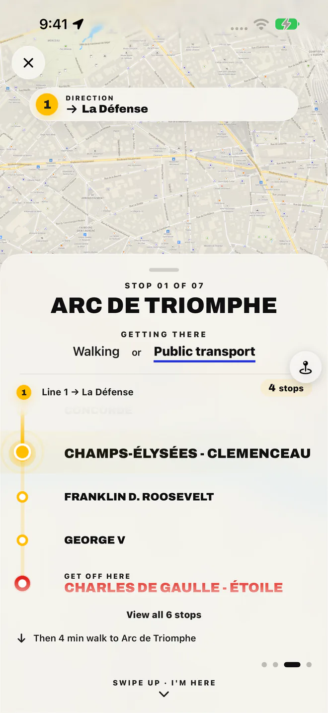
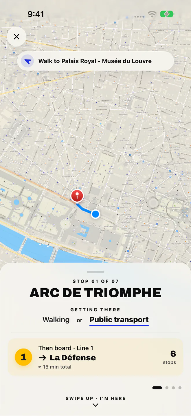
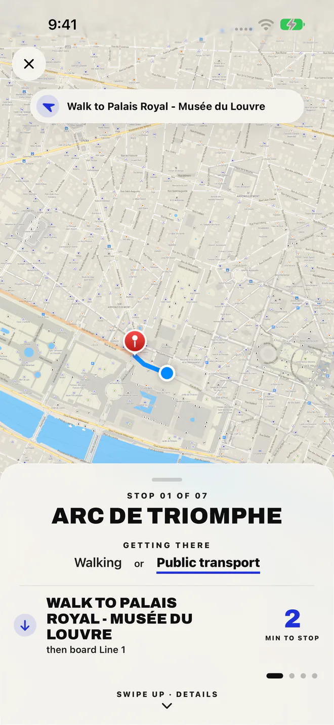
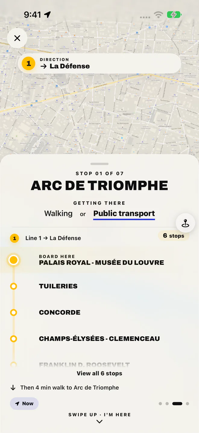
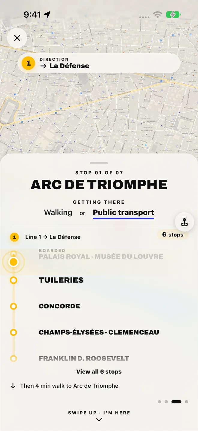
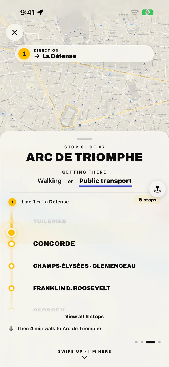
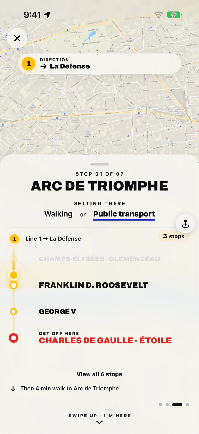
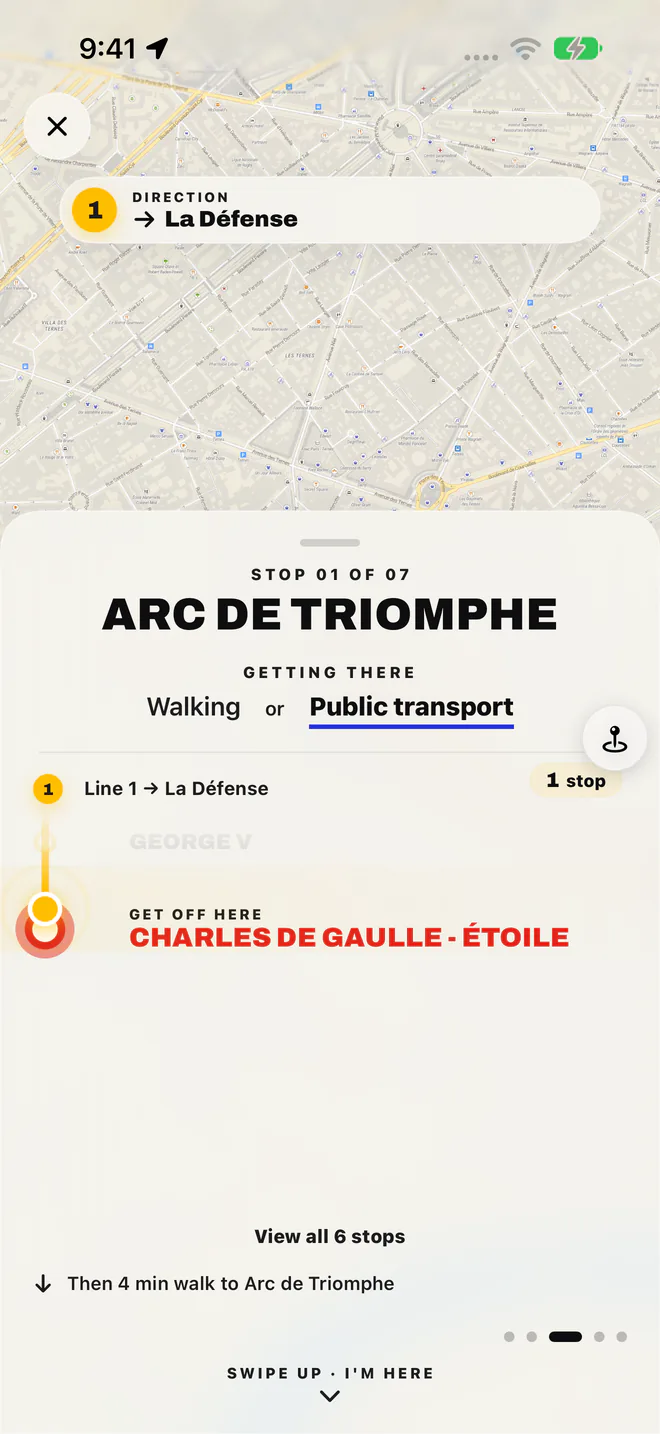
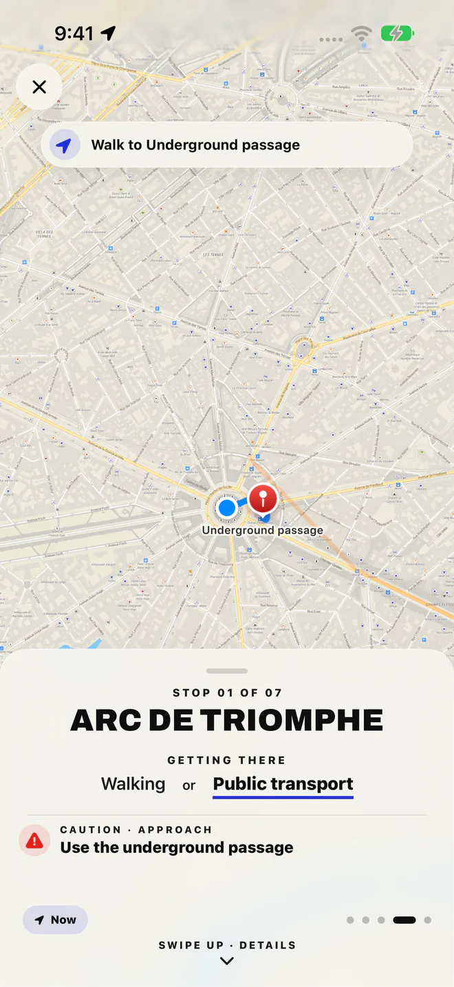
Pick where you’re going. The app works out the trip from where you stand.
From wherever you are in Paris, it plans the way to the start of the Triumph Trail, or on to the next stop, by métro, RER, tram or bus. It uses the timetable stored on your phone, so it needs no signal.
Walking directions first.
Turn-by-turn directions lead you on foot to the station, on the map stored in the app.
Which line. Which direction.
A Paris direction is named after the last station on the line, and the platform signs show that name. The app tells you both before you board.
How many stops.
The app shows how many stops are left. Allow Motion & Fitness and the directions move on by themselves as you ride, even underground.
Where to change.
When a trip needs a second line, the app tells you where to change and which line and direction to take next. In the station, connections are signed Correspondance.
When to get off.
The app tells you when to get off, then walks you on to the stop.
Three things to do before you leave, so the directions are ready when you’re offline.
Download the app and the Triumph Trail before you go. After that, no data and no roaming.
The app plans each trip from where you are. Your location stays on your phone.
Guidance starts once you’re in Paris. Before then, preview the tour from anywhere.
No sign-in, no ads, no analytics.
The métro, with the app in your pocket. For help with the app itself, see Support.
Yes. Paris Like a Local stores a journey planner and ride guide for every métro, RER, tram and bus line on your iPhone, so it gives directions with no data or roaming. It takes you to the start of the Triumph Trail and between its stops. Install it on Wi-Fi before you go.
Each métro direction is named after the last station on the line, and the platform signs show that name. Paris Like a Local tells you the line and the direction before you board. From the Louvre to the Arc de Triomphe, for example, it is Line 1, direction La Défense, for 6 stops.
The app shows how many stops are left and tells you when to get off. Allow Motion & Fitness and the directions move on by themselves as you ride, with no signal needed.
The app tells you where to change, and which line and direction to take next. In the station, follow the signs marked Correspondance to the next platform.
Every métro, RER, tram and bus line. The app uses them to get you from wherever you are in Paris to the start of the Triumph Trail, and from one stop to the next when it is too far to walk.
You can preview the Triumph Trail from anywhere. Guidance, including the métro and bus directions, starts once you are in Paris.